
Seeking Resiliency in South Florida
Fadi Masoud, Miho Mazereeuw
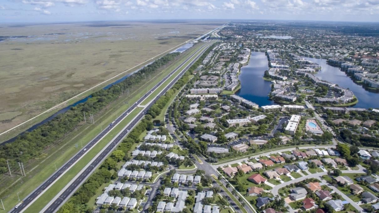
With nearly 20 million residents, Florida is one of the country’s fastest growing states. Its predominantly suburban landscape is enabled by the continued manipulation of a dynamic estuarine environment and a developer driven housing sector. Thirty-five miles of levees and two thousand hydraulic pumping stations drain 860 acres of water per day, resulting in the ‘world’s largest wet subdivision’ with US$101 billion worth of property projected to be below sea level by 2030. The overall structure that defines Florida’s cities emerges from the combination of hard infrastructural lines, master plans, reductive normative zoning, and rigid form-based codes. These conventional tools have proven marginally effective in dealing with the increased vulnerability caused by Florida’s inherently dynamic environment. In 2010, through the Southeast Florida Regional Climate Change Compact, several counties in South Florida began a review of their physical planning documents. The Compact brought together Broward, Palm Beach, Monroe, and Miami-Dade counties in response to the inaction of the State government to represent “a new form of regional climate governance designed to allow local governments to set the agenda for adaptation” and “to foster sustainability and climate resilience at a regional scale.”
Over the last two years, faculty and students in the MIT School of Architecture and Planning, with the MIT Norman B. Leventhal Center for Advanced Urbanism, have been engaging with these issues by working with stakeholders in the region on a series of design studios. The studios challenge existing planning tools, such as land use and zoning, given the inherent dynamism of the region’s landscape. They also explore ways in which the program, form, and use of the built environment can be enriched by environmental systems and processes. Currently, the team is working on developing a digital platform to showcase spatial data and mappings, existing studies, and schematic propositions developed through the studios that address resiliency planning and design, both in Florida and around the world.
This research puts front and center the agency and efficacy of existing planning tools as they deal with issue of climate change vulnerability. It assumes a new state for urban development, one that embraces a landscape in flux as the starting point of a novel and contextual process-based language for coding the future of Floridian urbanism.
This research is supported by Sam Tak Lee Real Estate Entrepreneurship Lab Faculty Research Seed Grant.
Learn More
Main, Kelly Leilani, Miho Mazereeuw, Fadi Masoud, Jia Lu, Aditya Barve, Mayank Ojha, and Chetan Krishna. "Climate action zones: A clustering methodology for resilient spatial planning in climate uncertainty." In Enhancing Disaster Preparedness, pp. 241-258. Elsevier, 2021. https://doi.org/10.1016/B978-0-12-819078-4.00013-7